How To Use Google Maps Immersive View To Vacation Plan Like a Pro
Google Maps’ newest feature lets you scout out restaurants and museums from the comfort of your couch.

Traveling can be a gamble, but Google Maps Immersive View attempts to tip the odds in your favor using AI.
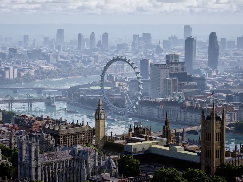
Immersive View creates dynamic 3D models of travel destinations in multiple cities across the globe and with a little know-how, it could be an invaluable tool. Here’s how you can use it to become a vacation planning pro.
What is Google Maps Immersive View?
Immersive View is a feature being introduced by Google that creates 3D models of locations using “Neural Radiance Fields” (NeRF), compiling multiple images together to create a 3D model that “accurately recreate(s) the full context of a place including its lighting, the texture of materials and what’s in the background,” according to Google.
The feature was announced last year, following the introduction of 3D models of significant landmarks, and is currently being rolled out to Maps users.
This means that, with enough images (something that’s easy when some landmarks have almost a million photos), Google can simulate the building from any angle, at any time of the day, to a high degree of accuracy without all the effort of generating models of entire cities one landmark at a time.
Currently, the feature is only accessible in the Google Maps mobile app for a small portion of users and is not yet available on desktop. While prioritizing mobile functionality makes sense from a use-case perspective, it’s a bit disappointing that you won’t be able to view any of these models at a higher resolution than your phone screen for a while.
How to use Google Maps Immersive View?
If the feature is available on your device, accessing it is pretty simple:
- Open Google Maps
- Select a location in a compatible area (London, Los Angeles, New York, San Francisco, and Tokyo, currently).
- If the feature is available, there will be a 3D render of the location directly underneath its name, where user-contributed images would normally be.
- Tap on the render, and an interactive 3D map of the area will appear with various pieces of information.
- Directly beneath the render, there should be a “Time and Weather” button that opens a timeline showing the current weather and how busy the location is.
- The timeline can be moved by sliding, which will show future weather forecasts and adjust the render to account for the weather and the position of the sun.
- If the feature is not accessible, the same location will be occupied with user-contributed images. For some locations, there will also be a pre-rendered video of a 3D model that will play when opened.
Enhance, enhance.
Google Maps Immersive View has two distinct modes: full-building and interior rendering.
The big-picture views will show up in the Google Maps app when looking at compatible cities (like London, Los Angeles, New York, San Francisco and Tokyo), and is useful for mapping out entrances, exits, and general building layouts, along with getting a sense of the surrounding areas.
Interior rendering can be used to get a sense of a restaurant's interior design, seating situation, and lighting to decide whether or not it’s the right place for your night out. Or, as Google puts it, it’s good for “understanding the vibe of a spot” before you get there. Along with that, it can be used to help determine how accessible a restaurant is for those with mobility issues or other disabilities.
While Google has only rolled out these features for a few select cities on certain devices, it plans to incrementally introduce the features to other cities in the future, with the goal of expanding to Barcelona, Dublin, and Madrid in the coming months.
What other features is Google introducing with this update?
Along with Immersive View, an augmented reality system called Search with Live View is being added to Maps. Search with Live View is meant for navigation while at your destination. In compatible cities, you can open up Google maps and lift your phone to eye-level to get a readout of nearby restaurants and businesses — information on hours, ratings, and how busy the restaurant is — along with locations of nearby ATMS, parks, and transit stations.
The feature builds on the already-existing Live View feature, which uses augmented reality to help find restrooms, taxi stands, car rentals, and other services. The existing Live View feature is currently being updated with over 1,000 locations across Europe, Asia, and Australia.
Google is also adding more in-depth EV Charging information for vehicles with Google Maps built-in (including charging stations, although the Tesla stations don’t appear to be updated on Maps to display whether they can charge non-Tesla vehicles), and “glanceable” lock screen navigation notifications when walking, biking, or taking public transport.
This article was originally published on