These 3 Maps Explain the 4.5 Magnitude Earthquake in San Francisco
The quake hit early Thursday morning.

San Francisco was hit by a 4.5 magnitude earthquake in the early hours of Thursday morning, shaking communities awake with a number of jolts over the course of a few seconds. The quake was centered on the Hayward fault, which has shown activity in recent years that scientists fear could lead to a far larger quake.
The L.A. Times claims that residents as far away as Silicon Valley felt the quake, which hit at 2:37 a.m. Pacific Time and woke up residents. One woman was woken up by picture frames falling, followed by a fire alarm trigger that called the police and fire department.
The Hayward fault causes a major earthquake around every 160 years, give or take about 80 years. The last one, in 1868, was an estimated 6.8 magnitude and killed around 30 people. Thankfully, Thursday’s event 150 years later was a relatively minor quake: around 30,000 earthquakes take place on this scale annually, and they only cause minimal destruction if any.
The fault has the potential to inflict far worse damage. In October 2016, four researchers writing in Science Advances found that a simultaneous rupture with the linked Rodgers Creek fault would create a 7.4 magnitude quake that would cause “extensive damage and loss of life with global economic impact.”
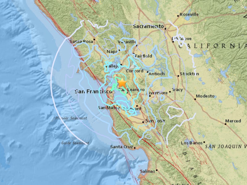
Here are three maps produced by the U.S. Geological Survey that help explain Thursday’s phenomenon:
Fault Zone Map
Map.
This shows the quake as felt from varying distances. The lighter the color, the lower the intensity. The star is the epicenter of the quake. In the above map, the quake was detected as much as 80 miles away in Sacramento, but at that point the intensity reached its lowest ebb.
Feeling Map
Did you Feel It? Map.
This map takes reports from people that felt the quake to build up a picture of perceived intensity. It shows that the nearby city of Concord, 16 miles from the fault, experienced a V rating on the Mercalli intensity scale, meaning that almost everyone would have felt it. Walnut Creek, the blue square directly down from Concord, only felt a II rating, indicating that only a few people on the top of buildings would have felt it.
Shake Map
Shake Map.
Not every measuring station felt the same intensity. The RWSVT San Pablo Dam, just 10 miles north of the fault, registered an intensity of I, indicated on a map here by the white triangles. This is despite the fact that most other stations in the area reported a V intensity quake to the USGS.
The map also shows how people’s perceptions may differ from measuring equipment. While Concord residents reported a high intensity earthquake to the USGS, measuring equipment shows the quake was within expected intensity with that distance from the fault.