How Do Navigation Apps Handle the Los Angeles Wildfires? We Asked Waze
How to navigate disaster.

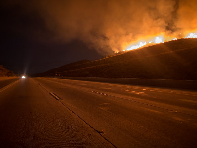
The ongoing wildfires in Southern California have destroyed hundreds of homes and forced 200,000 people to evacuate. And with so many fleeing for safety, people have suddenly had to confront a once hypothetical question: How well can navigation apps like Google Maps or Waze deal with unfolding natural disasters? We reached out to Waze to find out.
The issue was thrown into sharp relief on Wednesday when the Los Angeles Police Department asked residents to avoid navigation apps that were redirecting drivers toward roads with light traffic — roads that were empty in the first place because the wildfires were actually burning nearby. Reports from Twitter users also indicated apps like Waze were directing drivers to neighborhoods affected by the fires.
To get more of a sense of how Waze — which, like Maps, is owned by Google — deals with the challenges of offering real-time directions during a natural disaster like the wildfires, Inverse reached out to the team behind the app.
When asked about Wednesday’s reported troubles, a Waze spokesperson said that as of Friday afternoon the app has closed approximately 443 road segments in consultation with the L.A. Department of Transportation and listed 22 available shelters for those displaced. They provided a general statement on the situation previously shared with other outlets.
“Crises are by nature unpredictable, and as fires moved rapidly and changed course the task became more challenging,” the statement reads in part. The entire statement is included at the bottom of this post. “That said, we believe the process worked as efficiently as it could and we’re proud of the work done by all parties. “
When asked more specific questions about the role Waze can play in a crisis, the spokesperson pointed to the app’s potentially unique advantages:
Our community of drivers, paired with our long-standing network of municipal partners is actually what puts Waze in a unique position as the only resource to offer real-time routing and information. Waze acts as a resource to connect local offices with its citizens during a crisis. Our existing government relationships provide us with real-time information on official road closures. In addition to working with L.A. Emergency Management teams and LADOT, who provided road closure data, our local map editor community works around the clock to ensure that the map stays up-to-date.
During a crisis, we are able to speak directly with the authorities on-the-ground to ensure our map is accurate from the moment a crisis begins. As partners provide us with up-to-date data on an ongoing basis, we’re able to make sure our map remains fluid and continuously updates according to the changing conditions in an area. No one knows more about what’s happening on the roads than drivers themselves and the Waze community is always eager to share their experiences with others on the road.
The spokesperson also offered this advice on how users can most safely and responsibly use the app during a crisis:
Firstly, we never encourage driving during any sort of natural disaster, unless absolutely necessary. If traveling during a natural disaster, users can search the word “Help” to find their nearest shelter, or pan on the map and click on the shelter icon. We also make it easy to identify various evacuation routes, when needed. In addition to marking their location on the map wherever they need help, Wazers can also leverage our new Roadside Help features and make emergency calls to be connected with police, ambulances, or the fire department – all without ever leaving the app. We do encourage our users to actively report what they are seeing as this is an added layer of data that helps us close roads and make real-time updates to the map. Everything shared with Waze gets updated to the map in real-time and shared with our community.
When asked if there was anything else people should know, the spokesperson emphasized user participation as an essential part of its ability to function most helpfully:
Given the crowd-sourced nature of the app, we take every report very seriously and take action to update the map as soon as we receive a report of a road closure or bad road conditions. You too can take an active role by adding road reports of accidents, or any other hazards along your routes to alert other drivers of real-time conditions.
Here is Waze’s full statement to the media on the reported issues with the app misdirecting drivers to fire-affected areas.
From the early hours of the L.A. fires, Waze Crisis Response and our devoted volunteer team worked in partnership with local municipal organizations to keep our maps updated and help drivers in affected areas. We were in direct contact with the L.A. Emergency Management team as well as the DOT who provided road closure data - everything shared with Waze was updated to the map in real time and shared with our community.
Crises are by nature unpredictable, and as fires moved rapidly and changed course the task became more challenging. That said, we believe the process worked as efficiently as it could and we’re proud of the work done by all parties. We appreciate the cooperation from local government agencies; thanks to them and to our local map editor community, we were able to keep map data and routing as accurate as possible. We’ll continue to update the map in real time to address the changing conditions on the ground and help Los Angelenos get around safely.