MIT Scientists Use Math to Predict the Next Great Hurricane
"Currently there is no method to explain when these extreme events occur."

Typically, people living in the path of a hurricane receive a decent amount of warning that a storm is on its way, giving them a chance to evacuate. Forecast models are sufficiently advanced to plot a hurricane’s course with reasonable levels of accuracy. But what if we could predict an extreme weather event before it even forms?
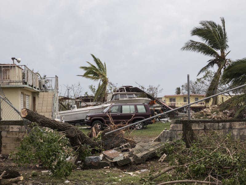
On Friday, Massachusetts Institute of Technology scientists reported in a Science Advances paper that they might be able to use engineering models to do so. Their work couldn’t have come at a better time: This hurricane season has been particularly fierce, with Harvey, Irma, Jose, and Maria — just to name a few — devastating public infrastructure and private homes in Puerto Rico, Barbuda, Texas, and Florida.
Using a series of engineering formulas, the researchers developed an algorithm for computing the precursors of extreme events in complicated systems with lots of turbulence.
“Currently there is no method to explain when these extreme events occur,” says Themistoklis Sapsis, associate professor of mechanical and ocean engineering at MIT and co-author on the new paper, in a news release.
“We have applied this framework to turbulent fluid flows, which are the Holy Grail of extreme events.”
A new algorithm may help predict precursor conditions to extreme weather events, like Hurricane Irma.
Previously, Sapsis has published work on how rare wave events can rise from otherwise calm seas, and his new research, which he conducted with MIT postdoc Mohammad Farazmand, rests on similar principles. “If we can predict the occurrence of these extreme events, hopefully we can apply some control strategies to avoid them,” Sapsis says.
The turbulent fluid flows he mentioned refer to the fluids that move in an irregular, rather than linear, way. Hurricanes are an example, as are any other fluid that moves chaotically, like extreme rainfall, air stresses around an airplane wing, and noise inside gas turbines.
The best tools scientists have for predicting when turbulent fluid flows will form are equations meant to to predict the behavior of a complex system over time, but they simply don’t have enough data about extreme weather events to plug into them. Extreme weather events happen so rarely that there’s just not much data about them — which is a good thing but is also a major obstacle in coming up with predictive technology.
"In the state space, extreme events are viewed as fast excursions away from the background attractor (blue ball) owing to small regions of stability," write Sapsis and Farazmand.
To replace the equations, the researchers built an algorithm, which combines those equations — specifically those relating to a type of turbulence called the Kolmogorov flow — with existing weather data to pinpoint conditions that qualify as “precursors” to turbulent flow.
They tested its accuracy by then running simulation of turbulent flows, then looking for the precursors that the algorithm had spit out. The precursors were accurate predictors of extreme events between 75 and 99 percent of the time.
A 3D rendering of a turbulent Kolmogorov Flow.
The upside to developing an algorithm that incorporates both predictive equations and real, representative data is because it separates the extreme cases from the exotic ones. There’s no point in identifying storm precursors that require conditions that would just never occur in the real world.
“We are looking at the equations for possible states that have very high growth rates and become extreme events, but they are also consistent with data, telling us whether this state has any likelihood of occurring, or if it’s something so exotic that, yes, it will lead to an extreme event, but the probability of it occurring is basically zero,” Sapsis says.
Their algorithm isn’t perfect yet, but the researchers hope that their research will help scientists around the world come up with ways to predict and even suppress the kinds of turbulence that can lead to extreme events. At the current rate we’re experiencing extreme weather events, every little bit helps.