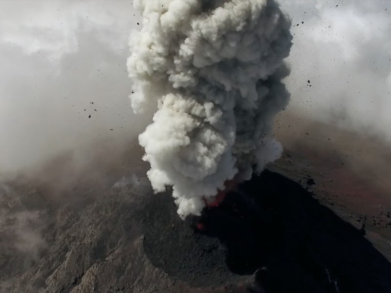
A team of researchers from Cambridge and the University of Brisol are using special, light-weight drones to survey previously inaccessible volcanoes in mid-eruption. Their work is creating not just new insights into how and why volcanoes erupt, but incredible aerial footage as well.
Their research focuses on an active volcano in Guatemala called Volcán de Fuego, which currently erupts multiple times per hour, and lets off a larger explosion every few weeks. It can spew ash and other toxic gasses in large enough quantities to be dangerous to surrounding communities, but just because the volcano can reach humanity doesn’t mean humanity can easily reach the volcano.
Like a volcanic version of Bill Paxton’s mission to study the interior of a tornado in the classic film Twister, these scientists were determined to collect both photos and samples from the still-rising plumes of actively erupting peaks — and with the most important ones hidden away several kilometers above sea-level, studying them on foot was simply out of the question. Not being Hollywood storm chasers, their solution was an autonomous drone.
In this study, the team is expanding on drones it developed for award-winning research into Ascension Island, an isolated volcanic island that also has unhelpfully active and high-altitude peaks. This drone had even tougher requirements, however, and the team switched from a quadcopter design to a fixed-wing drone. It had to be light enough and powerful enough to reach the required altitudes, without sacrificing the payload of scientific instruments it could carry — and worse, the drone would be flying “beyond the horizon,” meaning that it would have to be at least partially autonomous, as well.
The drone they produced to do this difficult job can measure temperature, pressure, and humidity, and autonomously target its high-definition cameras to capture the coolest explosions and most scientifically interesting formations.
The flight team (left to right): Colin Greatwood, Thomas Richardson, Ben Schellenberg, Emma Liu and Kieran Wood
It’s too early to say what insights scientists will be able to derive form these measurements, but one interesting discovery came not from the drone’s scientific instruments, but from its flight path data. According to Bristol PhD student Brian Schellenberg, the data show that in the future they should be able to let the drones “automatically identify when we are in volcanic emissions” and react accordingly.
Volcanology is a surprisingly broad and active area of research, whether it’s in the study of cryovolcanoes on distant moons or the possible development of an all-new volcano in New Hampshire (someday).