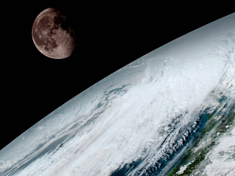
Earth’s orbit has a new friend in town: the GOES-16 satellite. This “geostationary” weather satellite is one of a series of four satellites thrust into space by the National Oceanic and Atmospheric Administration (NOAA) to provide better meteorological imagery and data for forecasters and scientists.
The GOES satellites are designed to predict severe weather with extreme accuracy and allow meteorologists on the ground to develop better warning and response approaches. GOES-16, originally named GOES-R, has just released its first images since its launch in November 2016, including this one, which shows the moon circling the Earth on January 15.
GOES-16 captures an image of the moon orbiting Earth. (NOAA/NASA)
The satellite’s suite of next-generation instruments offers high- resolution images and data by feeding off the magnetic atmosphere of the moon and the sun. It uses an intricate system of infrared, ultraviolet, and visible channels to detect even the slightest of changes in cloud and lightning patterns. It can even assess radiation for incoming astronauts and satellites.
GOES-16 is about 22,300 miles from Earth’s surface and scientists have already begun digging into the data.
“This is such an exciting day for NOAA!” Stephen Volz, director of NOAA’s Satellite and Information Service, said in a news release. “One of our GOES-16 scientists compared this to seeing a newborn baby’s first pictures — it’s that exciting for us. These images come from the most sophisticated technology ever flown in space to predict severe weather on Earth. The fantastically rich images provide us with our first glimpse of the impact GOES-16 will have on developing life-saving forecasts.”
GOES-16’s biggest potential has to do with helping forecasters make predictions about hurricanes. According to the United States Search and Rescue Task Force, America alone gets hit by about ten tropical storms every year and on average, six become hurricanes. There are about 45 million permanent residents living on America’s coastlines, which makes predicting storms with extreme accuracy imperative to safety.
GOES-17, the second satellite in the series, is currently under environmental testing in preparation for its launch. It will accompany GOES-16 in Spring 2017.