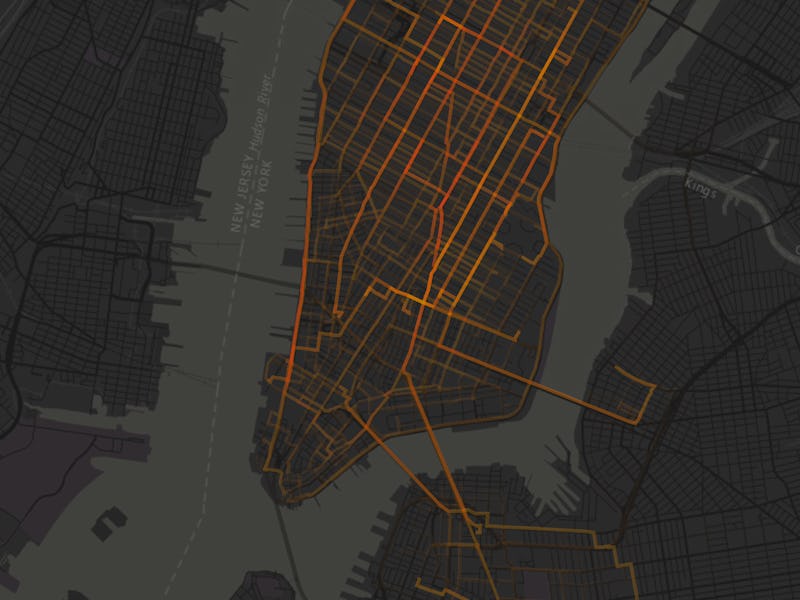
Bicycles have the potential to combat some of the carbon emissions arising from city transportation, and a map from the Environmental Systems Research Institute (Esri) shows just how much of an impact cycling across the city could have on pollution.
The map takes New York City’s CitiBike rental system and uses it to work out how much CO2 emissions are saved compared to the equivalent vehicle rides. This is only for CitiBikes, though, and doesn’t factor in private bike usage, but the data points from where a bike is collected and where a bike is dropped off give an impression of how much is saved per hour.
Take for example Friday morning, between 8 a.m. and 9 a.m. CitiBikes are saving around 1,854 pounds of CO2, with men traveling 1,682 miles over 815 trips. For women, 492 miles are completed over 227 trips, meaning that overall cyclists are completing around 2,174 miles in that hour. The map allows for drilling into select times of the week, as well as filtering by men and women.
During the weekend, the outer boroughs see an understandable spike in cycling traffic. Take Sunday for example:
It’s possible that these savings improve over the coming months, as on Wednesday, Ikea announced its Sladda cargo bike. Ideal for carrying groceries, the bike could save between 0.3 and 0.6 pounds of CO2 in a 5-10 mile store trip.
Cities still need to make some adjustments before bikes can start seeing serious savings in carbon emissions, though. In New York City, many bike lanes aren’t protected from traffic, and by August the city had seen around 15 cyclist deaths in Brooklyn alone. With Earth already past the point of no return for carbon emissions, the time to encourage more cyclists has already arrived.
Visit the Esri’s interactive map here.
