These Satellite Images Show Parts of San Francisco Are Sinking
The Millennium Tower is sinking very slowly.

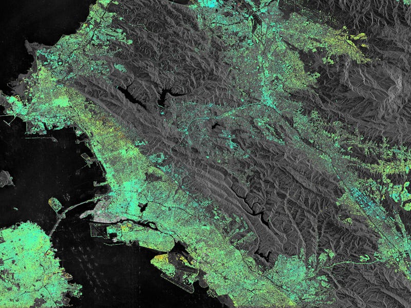
Perhaps the most famous sinking and unstable tower is the Leaning Tower of Pisa in Italy, but San Francisco’s Millennium Tower is experiencing a similar problem. New images from the European Space Agency show the 645-foot tower is slowly sinking into the San Francisco soil.
Satellite images taken in September 2016 were compared to ones taken in February 2015 and, over that time period, Millennium Tower and a few other spots around the Bay Area dropped in elevation, while others rose. The Millennium Tower actually sank about four centimeters, likely because it’s not properly positioned on the underlying bedrock. San Rafael Bay, to the north of San Francisco, also sank. Over in Pleasanton, California, (the lower right blue area), the ground actually rose a few millimeters. Scientists suspect this is thanks to replenished groundwater after the region’s long-term drought.
San Francisco, in the bottom left, is sinking.
The image also shows some activity along the Hayward fault, which runs north to south along the eastern side of the Bay. The Hayward fault has been pretty quiet since the late 1800s, probably thanks to the nearby San Andreas fault taking care of some of the tectonic tension in the area. But in the ESA’s image, some areas have sunk (in yellow), while other areas have been lifted (in blue).
Green indicates no change, and there’s still a lot of green along the fault and throughout San Francisco. It appears there isn’t any reason to start worrying about earthquakes or sinking cities just yet.