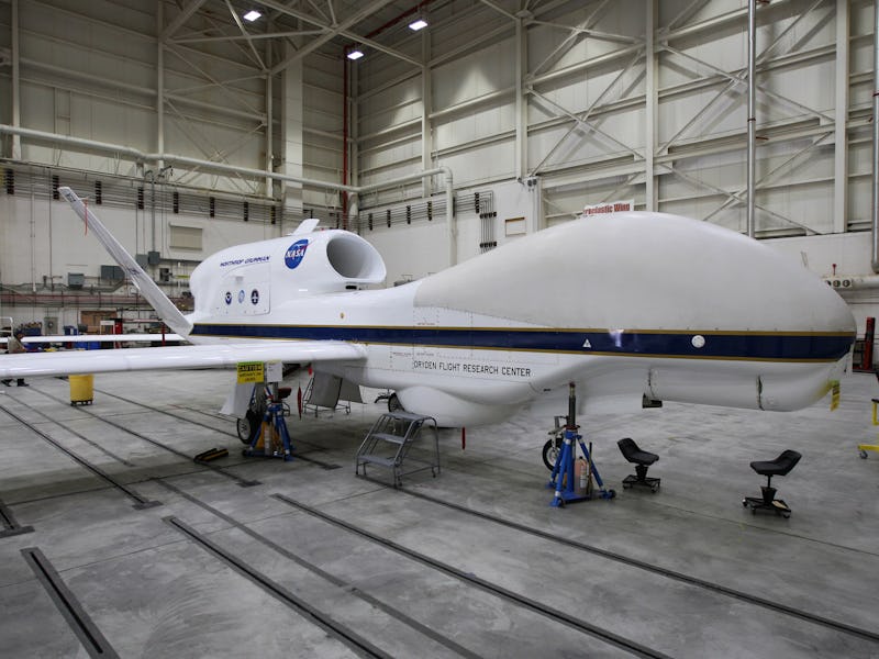
NASA Is Hunting El Niño Storms With a Special Military-Grade Drone
The Northrop Grumman Global Hawk surveillance drone is a weather predator.

An extra-warm, extra-crazy El Niño winter is causing havoc across the country, and particularly terrorizing the West Coast.
As usual, the government’s solution to terrorism is to use a drone. Thankfully, Northrop Grumman’s RQ-4 Global Hawk isn’t liable to shoot anything other than pictures anytime soon, but NASA’s special version of the plane is taking on storms out in the Pacific Ocean, hoping to put eyes in the sky on dangerous weather before it gets too close to land.
The Global Hawk is a surveillance drone, which means instead of rockets it’s mostly loaded with whatever high-tech sensing, seeing, or listening equipment the operators want it to have. The U.S. Air Force owns 33 of them, with more on the way, prizing them for their range and endurance.
Slightly-less-friendly whale-shaped drone.
NASA likes them for the same reasons — you can cram a bunch of sensors in them and keep them in the air for up to 24 hours at a range of 8,500-nautical-miles. For the military, that means you can keep monitoring targets for a long period of time before sending things to shoot them; for NASA, that means you can get a bird 60,000 feet in the air above the origin point of many El Niño storms, way out in the Pacific Ocean.
The Global Hawk is in the middle of flying a series of four to six, 24-hour flights as part of an ongoing National Oceanographic and Atmospheric Administration mission called Sensing Hazards with Operational Unmanned Technology. After thoroughly learning their lesson during Hurricane Sandy, NOAA is pumping money into new technology to make sure future storms don’t take them unaware. They want SHOUT to pioneer techniques of using autonomous vehicles like the Global Hawk to fill gaps other monitoring equipment can’t reach. For example, cloud cover can often obscure the view provided by satellites, something Robert Webb, Physical Science Division director of the Office of Ocean and Atmospheric Research for NOAA, says the Global Hawk can cut right through.
“It gives us a chance to really get ahead of the storm,” he said in a statement.
The Global Hawk uses a variety of equipment, including dropsondes, which are small tubes that measure temperature, moisture, and wind speed when dropped from the drone. It also carries the High Altitude Imaging Wind and Rain Airborne Profiler, which is a very complicated way of saying “an instrument that collects the same data a satellite could get, when a satellite can’t get it,” and another instrument to measure ozone layer levels as it flies.
“Every place the Global Hawk flies is like a layer cake and we see how it stacks up,” said Robbie Hood, director NOAA’s Unmanned Aircraft Systems program. “The data can be cross referenced and map areas in and around the storm, and we can watch how it develops. We are interested in understanding the data that can improve our ability to predict extreme weather.”
The NOAA is also has a Gulfstream IV research plane in the air and the NOAA ship Ronald H. Brown in the Pacific to add to the weather-intelligence gathering force, known as the El Niño Rapid Response Field Campaign.
The Global Hawk hit some turbulence earlier this month, when hackers from AnonSec revealed that they tried to hack into the Global Hawk and crash it into the ocean, which would have been a remarkably senseless waste of $222 million dollars of catastrophic-weather-fighting money.
Fortunately, NASA said AnonSec didn’t even ruffle the Global Hawk’s feathers, and the drone is still a-OK to fly.
You can check out a Northrop Grumman video on the RQ-4 drone family below.